News
Power of Clutter Height for Accurate RF Planning
The rapid growth of 5G networks worldwide and the everyday use of LTE (4G) are changing how mobile operators approach network planning and optimization.
With 5G – especially in mid-band and mmWave spectrum – radio propagation is strongly dependent on line of sight. Even relatively small obstacles can noticeably degrade or completely block the signal. In this context, reliable information about obstacle heights becomes essential for realistic 5G RF planning.
5G Planning in Canada: Why It Is Different?
Planning 5G networks over large territories in Canada is directly influenced by the country’s unique geography.
- Harsh climate conditions
- Complex relief – mountains, lakes, deep river valleys, extensive forest areas.
Because of this, 5G coverage today is concentrated in and around major urban centers. In remote or heavily forested regions, coverage may be limited or fall back to older technologies such as HSPA+, while deployment of low-band 5G in these areas is still ongoing.
Outside dense cities, to maximize return on investment, operators usually focus first on:
- Key transport corridors (highways, rail, logistics routes)
- Industrial and resource facilities (mining, energy, large agricultural areas)
OUR 2.5D GEODATA IS BUILT SPECIFICALLY TO SUPPORT:
- Propagation forecasting
- Wireless network (RAN) planning and design
We provide 2.5D maps for large regions or the entire country that allow RF engineers to:
- Improve prediction of signal attenuation and shadowing
- Evaluate the impact of terrain, buildings and vegetation on coverage
- Identify optimal locations for base stations and other transmitters
This combination of coverage and detail makes 2.5D maps a practical solution for nationwide and regional 5G projects.
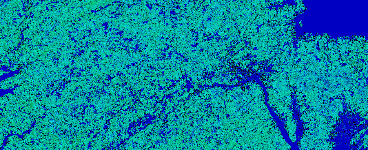
Clutter Height Layer, also referred to as the Digital Heights Model (DHM) is the Core of the 2.5D Model.
It describes height variations of the surface and above-ground objects and provides detailed height values at specific locations.
Accurate Clutter Height helps engineers to:
- See where links are clear, partly blocked, or fully blocked
- Choose better positions for towers and antennas
- Fine-tune antenna height and tilt to improve performance
To build the Clutter Height Model over large areas of Canada, we combine several modern techniques:
- Automatic obstacle detection on high-resolution satellite images
- Machine learning–based algorithms to generate a continuous obstacle model for wide territories
This approach ensures a consistent, repeatable quality of the height model, which is important for long-term 5G planning and comparison of different regions.
10 M REGIONAL MODEL – OPTIMAL BALANCE OF COST AND ACCURACY
For large-scale 5G rollout, the most practical solution is a Regional 2.5D Model with 10 m resolution. It includes:
- An extended set of clutter classes
- More detailed classification of urban territories
- A wide range of vegetation types and layers
To create the Clutter Heights Layer in our 10 m models, we use individual height sets for each clutter class, calibrated to Canadian conditions:
- Type of development
- Density and regularity of building patterns
- Types of vegetation, including dominant tree species
- Local relief and landscape characteristics
These heights are then assigned to each 10 m × 10 m cell of the grid. In this configuration, the vertical accuracy of the Digital Heights Model is typically 5–7 m, which is sufficient for regional and nationwide RF planning.
Explore Canadian 2.5D Data
You can explore our Canadian coverage with regional and city-level 2.5D maps to study how Clutter Height improves RF planning quality and helps operators design more reliable networks across Canada.
Ask us for free data sample in any RF- tool format for cities and regions of Maritime, Quebec and Ontario provinces: Contact US