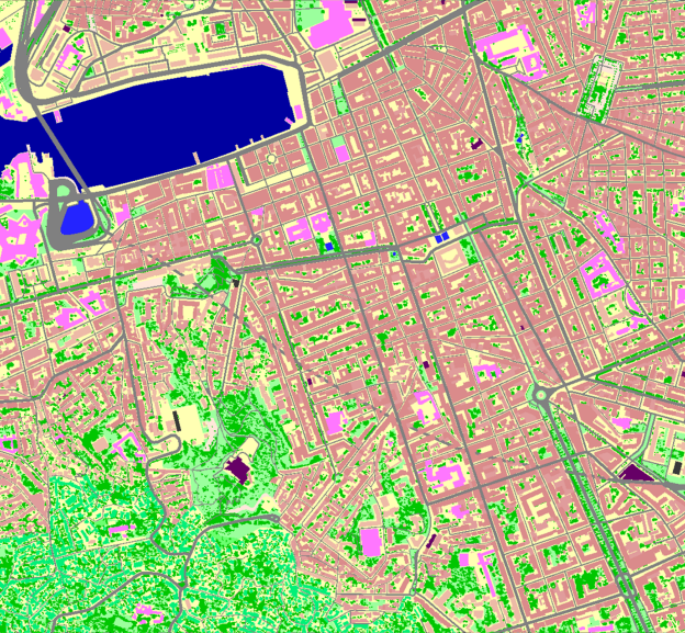
2D Models for RF Design in urban and suburban areas
2D Urban Models are medium resolution databases used for 3G/4G/5G Networks Planning in cities, regions and urbanized territories.
2D Urban Models are medium resolution databases – usually 5m for suburbs and 10m for urbanized territories within large regions.
2D Urban Models are suitable for 3G/4G/5G Networks Planning in cities and regions with not very dense and uncomplicated buildings. 2D Urban maps include Digital Terrain Model (DTM), Clutter Model, and Basic Vectors like street/road networks. Population distribution model delivered upon request together with the usual layers provides a better representation of land use and density ratios of the different urban/city classes.
2D Urban Models can be integrated into REGIONAL MODEL or combined with 3D Models of the core city as part of the multiresolution project. Our 2D Urban Models can be delivered in any RF planning tools and GIS format – Atoll, Planet, Asset, ISC Telecom, Esri shp etc.