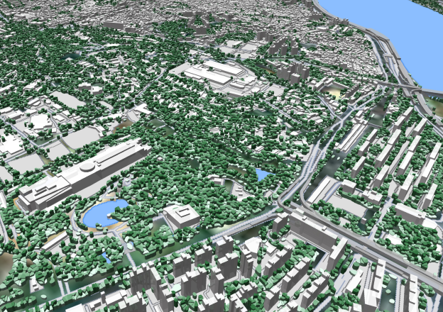
3D geodata sets for accurate 5G planning Our 3D geodata are designed specifically for 5G network planning. 3D maps are produced as high-resolution data sets of 1m, 2m, or 5m resolution. 3D Models provide precise Digital Terrain Model and above-ground features such as buildings, vegetation, and engineering constructions. Highly-accurate 3D buildings and 3D tree polygons […]
3D Buildings &Trees
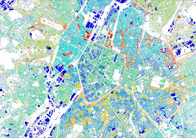
3D modelling of the urban environment We offer accurate 3D buildings and vegetation data for telecom and multiple applications in urban planning, utility planning, and environmental management projects, supporting all major RF and GIS data formats. 3D Buildings and 3D Trees layers can be manufactured as separate vector datasets or delivered as part of 3D […]
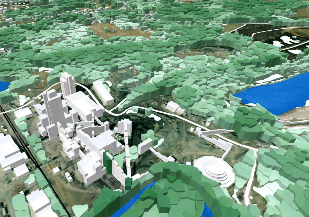
2.5D Models
2.5D Models – budget solution for 5G planning in towns, villages and suburbs 2.5D Models are developed as budget solution for 5G planning within large territories – metro areas, regions or entire country. 2.5D Models are developed for metropolitan areas where both man-made structures and vegetation impact wave propagation. It provides customers with almost the […]
2D Urban Models
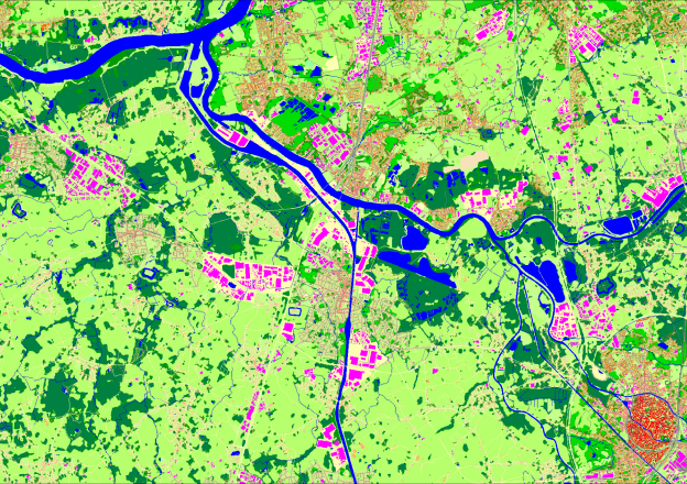
2D Models for RF Design in urban and suburban areas 2D Urban Models are medium resolution databases used for 3G/4G/5G Networks Planning in cities, regions and urbanized territories. 2D Urban Models are medium resolution databases – usually 5m for suburbs and 10m for urbanized territories within large regions. 2D Urban Models are suitable for 3G/4G/5G […]
Regional Models
Regional Models are medium-resolution databases for RF design over countrywide, regions or districts Regional Models are medium-resolution databases for RF design. We produce the data for regional planning over the world as 5m,10, 20m and 30m resolution datasets. The best choice for 4G/5G rollout is 10m resolution Regional model with an extended set of clutter […]
PopMaps
PopMaps (Population Distribution Model) is vital source data for network deploying, planning, and optimization Population distribution model is the important source for network deploying and optimization. It provides a better representation of land use and density ratios of the different urban/city classes. Population maps are delivered in the same resolution as your project. It enables […]

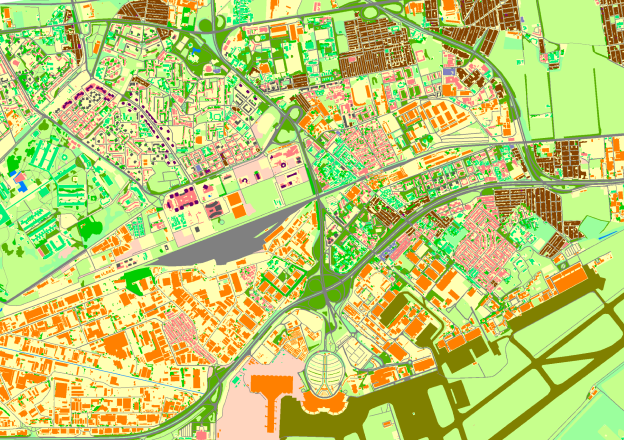
Geospatial Data
We produce a lot of Geodata in vector formats They can be used separately or as a unique data set aimed at the projects of Urban and City planning, Environmental management, telecom etc. Our Geospatial Data include: Complete and accurate datasets are ready to use for 2500+ cities and 85+ countries in .shp or .tab […]
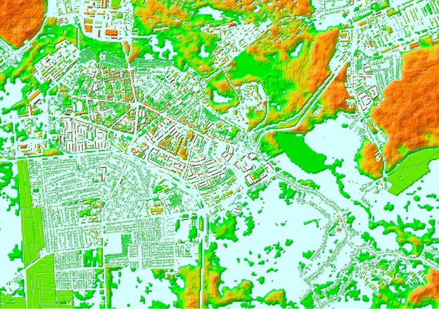
Elevation Models
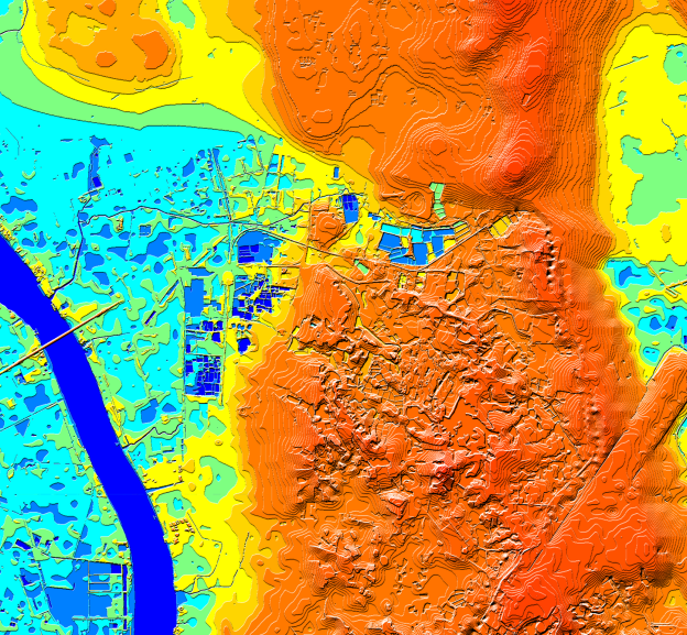
Digital representation of the earth’s terrain Digital elevation models are an important component of many geospatial projects – architecture, engineering, telecommunication, transport management, Natural Resource Mapping, etc. Depending on the aims of your project, the earth’s surface can be represented as: Digital elevation data are available in stock for 85+ countries worldwide and can be […]