News
As infrastructure and urban development projects continue across West Africa, access to reliable geospatial data becomes increasingly important for planning and analysis.
Together with VISICOM, boodmoe continues expanding geospatial coverage across Africa with new regional and high-resolution mapping projects. One of the latest initiatives focuses on Sierra Leone.
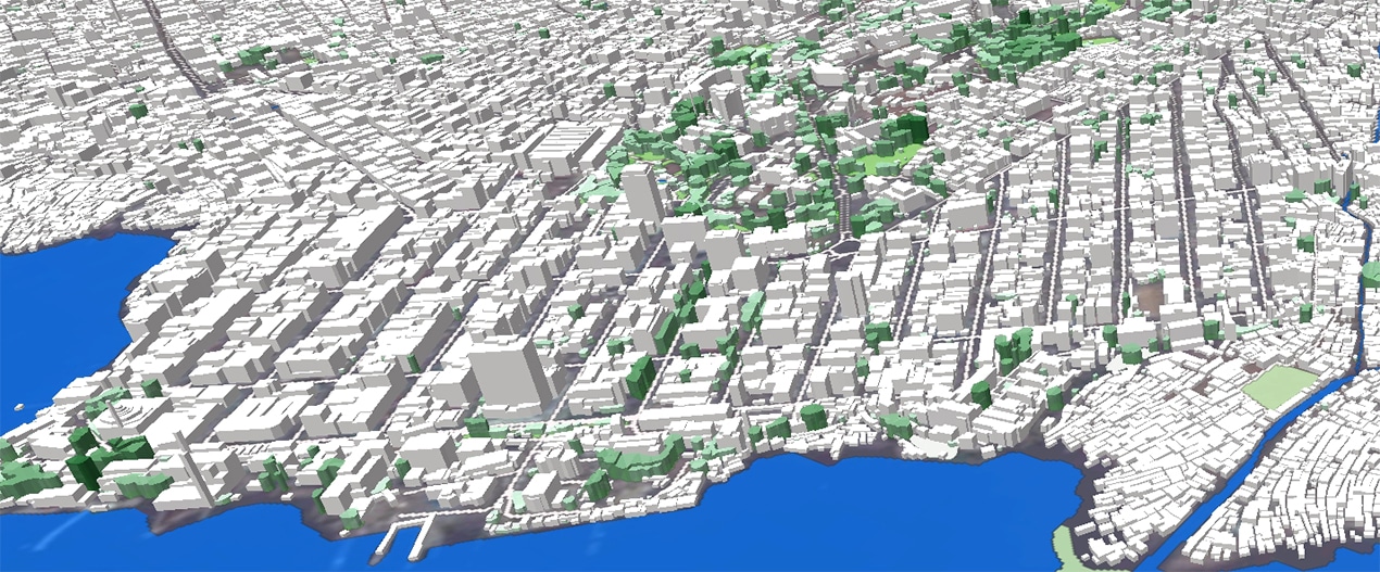
The project includes regional datasets, detailed 3D mapping data, and integrated population maps designed for both regional and urban-level analysis.
The delivered datasets include:
- regional 2D datasets with 20-meter resolution;
- population maps for regional analysis;
- high-resolution 3D datasets with 2-meter and 5-meter resolutions;
- integrated population data for urban and regional assessments.
The combination of regional coverage and detailed 3D data allows users to work with different planning scales within a single geospatial framework.
As development projects continue across the region, geospatial datasets that combine mapping and demographic information become increasingly useful for long-term planning and decision-making.
The datasets can support infrastructure planning, telecom network development, spatial analysis, urban growth assessment, and demographic studies.
All data layers were developed with compatibility and scalability in mind, allowing seamless integration into GIS platforms and analytical systems.
Through its collaboration with VISICOM, boodmoe continues supporting geospatial initiatives across Africa and providing access to modern mapping solutions adapted to real operational needs.
We have extensive experience in delivering 3D city models for urban and city planning across the African region, including the following countries: Algeria, Angola, Djibouti, Egypt, Equatorial Guinea, Ethiopia, Ghana, Kenya, Libya, Mali, Mauritius, Mozambique, Nigeria, São Tomé and Príncipe, Seychelles, Somalia, South Africa, Tanzania, Tunisia, Senegal, Sierra Leone and Morocco.
Contact us at [email protected] for more details, free samples, and case studies.