
Our completed projects in Q2 2023

The second quarter of calendar year 2023 saw the completion of several key projects worldwide
PHILIPPINES DIGITAL MAPS

Tailored to the needs of the telecom market, our geodata products for the Philippines enable our telecom customers to achieve accurate results in network planning and optimization.
3D Geodata for Canadian cities

Recently we have completed a large and comprehensive 3D project, which encompasses 14 Canadian cities. It was produced for massive MIMO mm-wave network planning (5G) and advanced 3D simulation in urban environment.
2D Urban project for Chile

We continue to cooperate with telecom companies in Latin America, producing 2D and 3D mapping products and delivering high-quality Geodata. One of our recent projects – 2D city maps for 58 cities of Chile.
Mexico City

Mexico City is the capital and largest city of Mexico and the most populous city in North America, with a population of over 9 million people and an area of about 1500 sq.km. It’s now a fast-developed megapolis that keeps building with many skyscrapers and contemporary constructions.
Singapore 3D maps for 5G planning

The project includes full coverage of 3D vegetation, 3D building vectors, 3D obstacles (bridges, chimneys, etc.), Road network, Digital Terrain Model (DTM), Digital Surface Model (DSM), Clutter/ Land Use classification.
3D Digital Maps for cities of Germany

We are glad to support all telecom and GIS companies in Germany providing them with accurate 3D city maps. All models are performed at high-quality level with attention to finite detail of building, terrain, transportation network, etc.
Tanzania map project

3D and 2.5D Maps of Tanzania cities cover the area 2000+ sq.km – Dar es Salaam – 1600 sq.km, Dodoma – 400 sq.km, more cities will be available soon. 3D Geodata accuracy it is 2-3m in X, Y, Z. Buildings detailing: LOD 1.3.
Mapping all of Myanmar
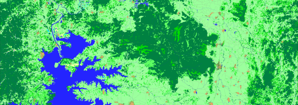
The vegetation layers and their heights were captured using the recognition algorithms which are based on artificial intelligence (AI), in particular neural networks. Data formats
Our projects 2020

Despite the COVID-19 and quarantine, boodmoe and Visicom teams worked very efficiently in 2020.We have successfully completed 25+ projects for more than 2,500,000 sq km, providing high-quality geodata for various customers and markets (telecom, solar energy, architecture, smart cities, etc.).